Seismic shake-up: digitising 90 years of Queensland’s earthquake history
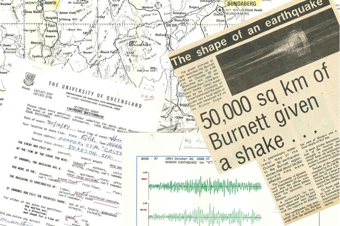
Records relating to an earthquake in October 1984, Queensland’s South Burnett region.
(Photo credit: The University of Queensland. )
Key points
- A UQ-led project is digitising 90 years of Queensland’s earthquake records to improve hazard modelling and emergency preparedness across the state.
- The archive includes scientific data and public reports, helping map ground shaking variations and guide infrastructure resilience standards.
- The work is supported by the Bryan family, whose legacy in Queensland seismology spans generations, and undertaken with the help of Jigsaw Australia.
A landmark project is digitising almost a century of Queensland’s seismic records to help scientists and emergency services better understand the state’s earthquake risk.
Led by Dr Dion Weatherley, Senior Research Fellow at the Sustainable Minerals Institute, the project also marks 90 years of seismology at The University of Queensland.
“Coincidentally, earlier this year Southeast Queensland experienced the largest earthquake in the state in 50 years,” Dr Weatherley said.
“Fortunately, the August 16 quake struck in a sparsely populated area about 250km north of Brisbane.
“But at 5.6 magnitude it was comparable to the 1989 Newcastle earthquake which claimed 13 lives and caused billions of dollars in damage.”
Dr Weatherley said damaging earthquakes were rare in Queensland, occurring every 100 years or so, but could still cause serious damage, especially if near a major centre.
“The fact earthquakes don’t happen often here means communities can be underprepared, and having easy access to historical data can help improve our resilience.”

A seismogram for an Earthquake at Murgon in 1984.
(Photo credit: The University of Queensland.)
Archives and anecdotes
The UQ digitisation project includes material dating back to the 1920s.
“There’s a mix of public observations, scientific notes, newspaper clippings, and historical records that give us a clearer picture of how earthquakes have affected Queensland communities,” Dr Weatherley said.
“These ‘felt’ reports combined with data help us understand how ground shaking varies across different geological conditions, which is essential for hazard modelling and emergency planning.”
Dr Weatherley said the digitised records will support Geoscience Australia’s national seismic hazard mapping, which informs the Australian Building Code and guides earthquake resilience standards for critical infrastructure.
“Hospitals, emergency service buildings and dams in Australia must all meet earthquake loading standards, but it’s not a requirement for low-occupancy residential buildings, ” he said.
“Shaking from a quake can vary even within the same suburb, depending on whether a building sits on bedrock or sediment.
“That’s why felt reports and anecdotal data are so valuable in helping us build detailed shake maps and improve hazard models.”
The digitised archive will also support planning for vulnerable infrastructure, including Queensland’s heritage buildings and older schools that were built with unreinforced masonry.
“Masonry without reinforcement can pose a problem in quakes because parapets and facades can collapse,” Dr Weatherley said.
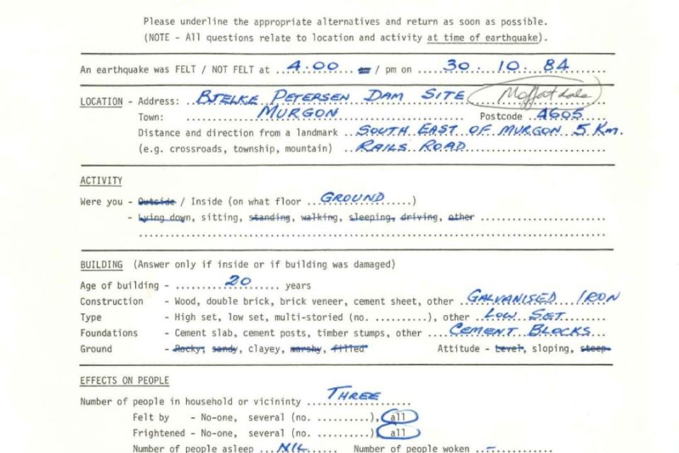
An earthquake "felt report" from the area of the Bjelke-Petersen Dam in October 1984.
(Photo credit: The University of Queensland. )
Technology and philanthropy
The clerical and digital archiving is being carried out by trainees in Jigsaw Australia, a social enterprise that trains, employs, and transitions people with disability into mainstream employment.
The team is scanning and cataloguing using Optical Character Recognition (OCR), making the records searchable and accessible for future research.
Funding for the project has come from a range of sources including the Bryan Family Group, and The Bryan Foundation, a philanthropic organisation that helped connect Jigsaw Australia to this project. These Bryan Family organisations have deep ties to UQ’s seismology history.
The Bryan family’s connection to Queensland seismology spans 90 years, beginning with Professor WH Bryan MC, who founded the field at UQ in 1935.
His grandson, QUT Professor Scott Bryan and the Bryan Family Group and Foundation have continued the legacy through ongoing support for seismic research.
The UQ Seismology Station at Mt Nebo was founded by WH Bryan and bears his name to honour his pioneering seismological research in Queensland. It is now run by Dr Weatherley.
“The Bryan family has been instrumental in supporting seismology and finding innovative ways to help protect Queenslanders from natural disasters,” Dr Weatherley said.
The first digitised records are expected to be online later this year.
The archive will be made available to researchers, planners and emergency services.
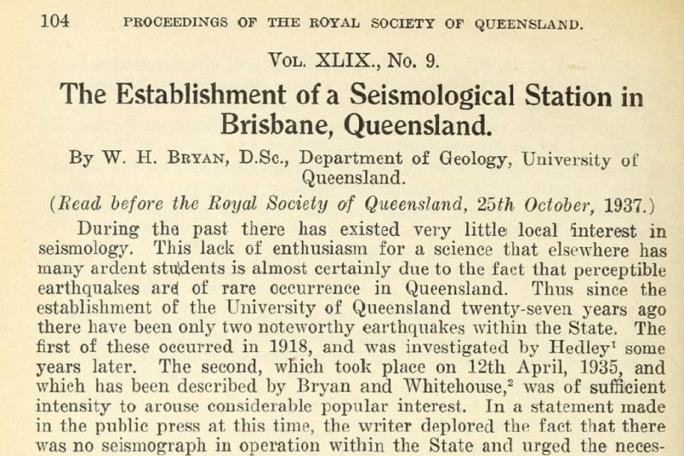
W.H. Bryan discussing the state of seismology in Queensland and the establishment of a seismological station.
(Photo credit: The University of Queensland.)
Related articles

Anyone can be a hacker with AI – so what does that mean for the cyber defence industry?