International mapping partnership to tackle coral reef crisis
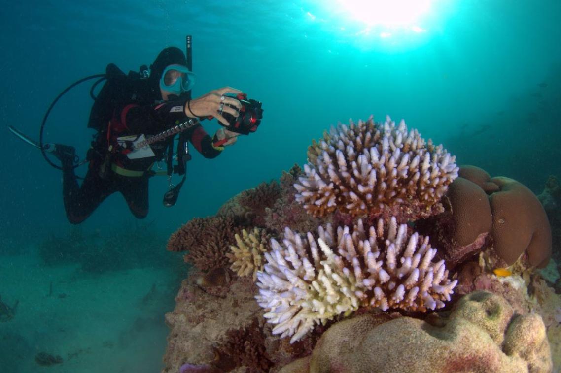
The University of Queensland is part of a global mapping and monitoring partnership using satellite imagery and big data processing to respond to the crisis facing coral reefs.
UQ Remote Sensing Research Centre directors Professor Stuart Phinn and Dr Chris Roelfsema are lead researchers in the global coral reef science and conservation mapping and monitoring program launched in the US this week.
Less than a quarter of the world’s reefs were sporadically mapped or monitored by SCUBA and light aircraft or, in a few places, lower resolution satellite images.
“The Remote Sensing Research Centre team has focussed on coral reefs since 1998, and have developed and applied mapping and monitoring methods for reefs throughout the Asia-Pacific and the Caribbean,” Dr Roelfsema said.
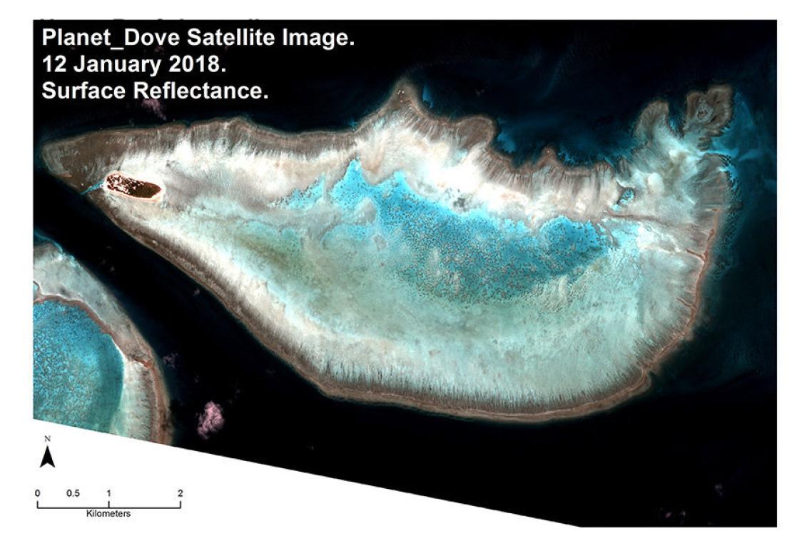
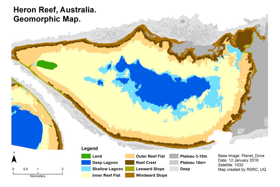
“The partnership will provide the first seamless mosaic of high-resolution satellite imagery of the world’s coral reefs and will deliver accurate maps of the features making up the reefs and how they are changing.” Professor Phinn said.
Professor Phinn said coral reefs covered less than one per cent of the ocean surface, yet nearly one billion people and 25 per cent of marine life depended on them.
“We need to know what is happening on reefs if we have any hope to save them,” he said.
In its first year, the partnership will produce a global mosaic, a global community engagement plan and five site-based maps to validate its image processing and mapping methodology.
The sites are Heron Island on Australia’s Great Barrier Reef, Moorea in French Polynesia, the Lighthouse Reef in Belize, Kaneohe Bay in Hawaii and Karimunjawa in Indonesia.
The researchers hope the project will expand its mapping in 2019 and encompass the entire globe in 2020.
Artificial intelligence will help detect changes on the reefs and alert conservationists and governments where action is needed.
The project is the result of a collaboration with Paul G. Allen Philanthropies, Planet, the Carnegie Institution of Science, The University of Queensland and the Hawaii Institute of Marine Biology.
It is funded by Paul Allen Philanthropies/Vulcan.
Media: Professor Stuart Phinn, s.phinn@uq.edu.au, +61 401 012 996, @RSRC_UQ, @stuart.phinn; Dr Chris Roelfsema, c.roelfsema@uq.edu.au, +61 7 336 56977, ChrisRoelfsema; Janet Greenlee, Paul G. Allen Philanthropies, janetg@vulcan.com, Trevor Hammond, Planet, Trevorhammond@planet.com.
Related articles
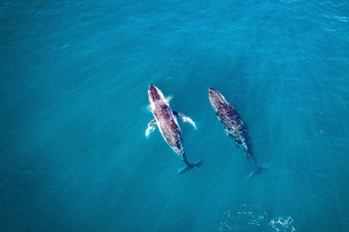
Decades of surveys show whale migration shift